Sunday 31 October 2010

Coast to Coast Sept 2010 Day 13

Grosmont Steam Railway
Day 13- Sept 13 OUR LAST DAY


Glaisdale to Robin Hood’s Bay 19mls. 1640’ascent

Weather- cloudy am. Becoming wet and windy!


What a shame it’s likely to be wet today- our first, and last, wet day on the walk. I can’t believe how lucky we have been, and how different the walk could have been.

AW loved the variety of the last leg of the walk, and it certainly lived up to its description.

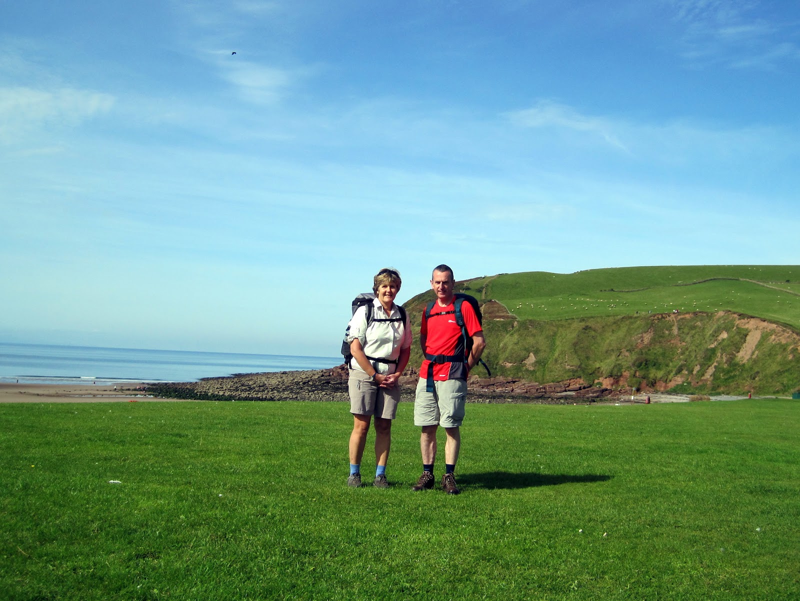
Our first stop- a brief look at Beggars Bridge, an old, picturesque 17th century bridge. Then a lovely walk through Arncliffe Woods, along the riverbank, and on to Grosmont and Grosmont Station. We were lucky enough to arrive just as a lovely old steam train was waiting at the platform. To the sound of its horn and the deep chugging sound as it pulled away, we began the very steep climb up, 1 in 3. Phew! On to open moor again- Sleights Moor, and a deterioration in the weather had us struggling in the wind to don overtrousers. Across the A169 Pickering road and over the moor, with views of Whitby Abbey in the mist, far off in the distance, and south to the “golf balls” of Fylingdales Early Warning System. Dropping down into the beautiful little village of Little Beck,we were on a woodland trail, later joining the falling Foss forest trail at The Hermitage, carved out of the rock in 1790, you can sit inside to shelter from the weather. On towards the Falling Foss waterfall- spectacular and the Falling Foss Tearooms- even more spectacular!!! My lunch consisted of two cakes and a great pot of tea, sheltering in the lovely tea-room gardens, under large garden umbrellas. Up over Sneaton moor, AW cruelly sends you North to the village of Hawsker, about 3miles out of your way. You appreciate why, later, when he has you doing a “lap of honour” around Ness Point, before arriving in RHB. But at the time, after such a long walk, it’s hard to think positively about such a detour! The only blot on an otherwise astonishingly beautifully scenic day, is the trail through Northcliffe caravan park, which seems to go on forever. But it doesn’t and before long you’re on the coastal path, up to your knees in mud, but exhilarated to be so close to the finish. With RHB in sight, a sense of achievement starts to creep in!


Throwing pebble into North Sea


Tired and filthy, we arrived at Wainwrights Bar in the quaint little village of Robin Hood’s bay. A romantic place in itself, but even more so for Ian and I, because we spent a weekend here when we both students, over 30 years ago! Ian had met us on the coast path, in fact he’d planned to meet us coming through Hawsker, but missed us, whilst taking shelter in the pub!!!

We threw our pebbles from the West coast into the sea on the East coast, and had photos taken etc. There’s a plaque on the outside wall of the pub, saying “The End- Coast to Coast 190miles” and it’s hard to believe we’ve done it, but we have.

A couple of pints of beer in the pub. Fish and Chips from the chippy. A long drive back almost to the start to drop Col off in Lancashire!!


Robins Hood Bay - Wainwrights Bar


Four weeks ago now. Knees finally settling down, but had been swollen for several days afterwards. Two black toe-nails. Need to wean myself off beer and pie, chips and peas!


I’d definitely do it again- Would do the high level route in the Lakes, if the weather was conducive- wouldn’t recommend it if it weren’t. But planning on an alternative to the trudge around Ennerdale Water, opting for the route of the Ennerdale

Coast to Coast Sept 2010 Day 12


North Yorks Moors
 Day 12 Sept 12 Clay Bank Top – Glaisdale 19mls 984’ascent


Weather again bright and sunny, but a cold breeze


As the figures suggest, a long but reasonably flat walk ahead today. Sitting in Judy and Stuart’s comfortable kitchen, enjoying a delicious cooked breakfast, talking about dogs and horses, and anything else, just to relax in their cosy house, it was very difficult to get going today!!!

But ahead a day of reliving the moment of 30odd years ago, when I ran the next section, as part of the Clayton-le-Moors Ladies bid for coast to coast run inside 24hours, which we achieved easily, thanks to Vanessa Brindle, Wendy Dodds, Karen Taylor and the like- all superb fell-runners. I ran my section with Ian in , and would expect to take significantly longer today.

After a brief climb up from Chop Gate, where Stuart deposited us, the only climb of the day almost, we pushed on over Urra Moor. Then we steamed along the disused Rosedale Ironstone railway line, with fast walking across the North Yorkshire moors. From High Blakey moor, we could see the Lion Inn at Blakey, the only building for miles.

We stopped there for some soup, and as I went inside, it was really impressive. Although only lunch-time, there were candles on all the tables, with the rambling dining area, spread out over three rooms. Very welcoming staff, and after I’d glimpsed the massive table full of various desserts, I was wishing that, like the Bamford Builders, we were staying here for the night.

But no such luck, we were bound for Glaisdale. After a break, in which we were caught up by the Calver mother and daughter, Danish and Martin, we were off on the flat again. This happened a lot- your never on your own for long, and are constantly joined by the same groups of people at lunch and break stops.

A brief stop at “Fat Betty” stone, to make an offering of chocolate, and pick up someone else’s trail bar, round Great Fryupdale and over Glaisdale Moor and then down into Glaisdale. Well, actually, we were staying at a farm for B&B- Hart Hall dairy farm, run by a lovely couple, Elaine and Dave. They politely requested that you waited until after 7am to have a shower, as it affected the electricity supply to the milking parlour. A very busy couple, raising a dairy herd, milking twice a day, caring for calves born during the night, running a B&B, and raising a family! Colin gallantly accepted the Harry Potter-sized bedroom under the stairs, because Australian John had taken his room upstairs. He’d had a much shorter walk today and, having arrived early, had bagged one of the two rooms upstairs! He’d been a pain on the first morning, having bagged the shower for his personal en-suite, and kept us waiting to use the loo! Ah well!

Just a note about the pub in the village- don’t bother going- food was great but some younger locals need to get out more! What passed for entertainment seemed to be a woman with a freakishly long tongue, who stuck it out suggestively, at any given opportunity to shock and amuse, I suppose, whilst her mates farted and burped their way through the evening! Hmmm! A good argument for increasing the gene pool in some rural areas!!

The best part of the evening was spending it having a meal with Birgitte (Danish) and Martin, a lovely couple living in London, both in the acting profession.

Coast to Coast Sept 2010 Day 11


Lord Stones Cafe

 Day11 Sept 11 Ingleby Cross to Clay Bank Top 11mls 2545’ascent


Weather wet start then became dry and bright


I was dreading today, as my knees were still very swollen. A lot of ascent, and more worryingly, descent today, but a much more interesting day in prospect. The Cleveland Hills.

Wainstones
We woke to the sound of Blackpool Donkeys having their breakfast, singing songs, and taking their tents down in the rain! Sooo glad I’m not doing that!

First a climb up to Beacon Hill, laden with its famous transmitters, with forest trails, giving way to moorland. The purple heather was looking wonderful, and we passed a team of grouse-beaters at work, raising a few grouse for the shoot. Then up and down, and up and down, until we came across the terrific little Lord Stones café, hidden in the trees, which is a bit further than half-way. Time for a nice bit of soup for lunch and a cracking cuppa, and then off again

Up and down to the end of Cold Moor, finishing with the impressive Wainstones- rocky outcrops. A lot of up and down today, but better than I was expecting. Knees sore but responding to regular anti-inflammatories. Knee support making a huge difference also.

We were staying at Stuart and Judy’s B&B tonight, and we rang him beofr we dropped of Hasty Bank and lost signal. For £35, we were provided with B&B, transport from and back to Chop Gate, and transport to and from the pub at night where I enjoyed a very filling Chicken Parmo, a local delicacy. Fantastic. Nicest, most comfortable place to stay, and difficult to wrench yourself away from, after a hearty breakfast in the morning!

This was where my leg of the relay started from, when I ran it 30odd years ago, with Clayton Harriers. The Blackpool Donkeys had another long day today, because they were going all the way through to the Lion Inn at Blakey Ridge (21mls), but then they would have two shorter days- to Grosmont (65mls) and then RHB(15mls).

Lots of different ways of doing this final section. Still bumping into the same groups of people on route. Mum and daughter from Calver were staying in the same B&B and sharing lifts with us last night.


Coast to Coast Sept 2010 Day 10


Ingleby Cross and Blue Bell
 Day 10 Sept10 Richmond to Ingleby Cross 22.7mls 560’ascent


Weather wet, then cloudy and mild later.

The most uninteresting, featureless, miserable part of the walk, but you do chalk up a good chunk of mileage, through the Vale of Mowbray. Arable/horrible land!!

Danby Whiske pub half-way, and lunch available. 8mls of boring road walking to follow. Most exciting bit was legging it across the busy A19 dual carriageway!

Relieved to arrive at the Blue Bell Inn, Ingleby Cross, where I’d booked B&B. Good place. Great food and good pub atmosphere, where we met all the usual suspects, Bamford Builders and Blackpool Donkeys, and Calver mum and daughter. Great atmosphere, chatting together. For me, one of the most important elements of the walk is socialising afterwards over a great pint! No sign of Danish and Beano, who, it transpired, had got very lost!

Not much else to say for today!!!

Apart from the fact that I’ve never had haute-cuisine pie, chips and peas before, served in beautifully presented little portions!

Coast to Coast Sept 2010 Day 9

Get Pints In....Richmond
Day 9 Sept 9 Reeth to Richmond 10mls 1100’ ascent


Weather Cold but sunny and windy

We walked along the river Swale towards Marrick Priory. Now an adventure centre, it was established in the 12th century, as a Benedictine Convent. Up through the wood over the 375 steps, known as the Nun’s Steps, and on to the village of Marske. Down to Clapgate Beck and the “Applegarth Riviera”, with magnificent views down to the river Swale all the way to Richmond, and its castle. A lovely easy day today. A day for ambling and enjoying. Not as dramatic as previous days, but pastoral and gentle.

Richmond is a bustling market- town, with all the facilities tired, sore bodies might require. So we opted for a new pair of socks, and a couple of pints! We were met by Ian at the pub. Hand-made, delicious cakes were on sale at the indoor market, so I bought a few for tonight’s pudding, as we wouldn’t be able to return to town this evening, the site being a least another 2mls away.

It wasn’t easy to find a site, but we opted for the nearest at Brompton-on-Swale. Ian and Colin headed straight back, but I opted for a little detour to Easby Abbey (ruins), and St Agatha’s Church. I’m glad I did, as the church, which dated back to the 10th century was full of marvellous medieval wall-paintings, dating back to 1205, depicting the story of Adam and Eve.. Then a lovely walk on through pastureland to the campsite.

Easby Abbey

This is not quite the route described by AW, which stays south of the river, whereas we’d had to go north slightly to find the site.

Coast to Coast Sept 2010 Day 8

Campsite Keld
Day 8 Sept 8 Keld to Reeth 11mls and 1790’ascent, depending upon which route you take


Weather Misty, damp and autumnal

Both routes start the same. We began today by watching sheep being rounded up by quads and ten sheepdogs, working in pairs, and driven over the narrowest of bridges. Just below Crackpot Hall, the route divides and you decide whether you want to follow the river Swale, or take the higher level route through the abandoned lead mines. We opted for the higher route with stunning views over the river valley. In the end, we made a mistake, and found a third route, through farms and villages. As it was, I’m not sure it was such a bad mistake, as the route through the mines sounded like a bit of an ordeal, being rough underfoot, and AW does recommend you find your own way! But the point is, that in many places the route is unmarked and indistinct.

Our route took us a lovely pastoral way, through Gunnerside and Heerlaugh, very quiet, isolated hamlets, all the time following the river Swals but from a higher level.


Crackpot Hall

We met Ian at Orchard Park caravan and camping site, in Reeth, set in an orchard, but quite difficult to find. Reeth seemed like a lovely place, with a village green and a couple of pubs. Ian and Colin went for a pint at the Black Bull. Danish Pastry and Beano recommended this as a place to stay, with the best pub food so far.

I stayed at the van, with frozen peas plonked on my knees again!


Coast to Coast Sept 2010 Day 7


Nine Standards Rigg
 Sept 7 Day 7 Kirkby Stephen to Keld 13mls 1690’ascent


Weather bright and breezy

Woke to a much better morning than expecting. After calling at the Chemists for knee supports and anti-inflammatories for very swollen knees, we were raring to go.

Kirkby Stephen is a lovely little market town, well off the beaten track, and a bit like stepping back in time, in a nice way.

Prospect of a very boggy terrain ahead.

It was an exhilarating walk up to the Nine Standards Rigg, very unusual stone cairns, approx 12’ tall, standing in a row on the brow of the hill overlooking the Eden Valley. They are visible for miles around. The next section of the walk follows a number of different routes, depending upon the time of year. From August to November you take the blue route, which takes you over boggy terrain and down into the delightful Whitsundale Beck. Although our feet were soaked it wasn’t as bad as we were expecting, as we dropped down to Ravenseat, and Amanda’s tea-rooms, as seen on TV. Sitting outside at a picnic table, laden with cream tea, home-made strawberry jam and delicious home-made scones, in the afternoon sunshine, in this beautiful stretch of countryside that I’d never seen before….I thought I was in heaven. Birgitta and Martin, alias Danish Pastry and Beano, clearly thought the same, as they were grinning from ear to ear. Worth the effort.

Ravenseats Cream Tea
We continued on following the Swale down towards Keld, past a series of waterfalls. Passed a really nice campsite, Park House, where the Blackpool Donkeys were staying, on the left approaching Keld. Then passed Butts House B&B and then onto our campsite, Park Lodge. A bit basic, but superbly situated with views down the valley to Swaledale. Called in at the Keld Lodge Hotel for a pint. Nice place but expensive.

What a wonderful place Swaledale is! The Lakes are magnificent, but Swaledale is magical also! Keld- a tiny little hamlet in an unspoilt area, which I know I’ll visit again soon.

Coast to Coast Sept 2010 Day 6

Crossing the M6 at Shap
Day 6 Sept 6 Shap to Kirkby Stephen 19.8mls 1755’ascent


Weather Cloudy and breezy


Another long day but much less climbing than we’re used to and much easier under-foot. Consequently a bit faster!

Today’s route began straight opposite the pub, over the M6 and skirted the Hardendale quarry. A far cry from the beauty of the lakes, but still a wild and lonely place. Looking back we could see High Street and the distinct promontory of Kidsty Pike. Already beginning to miss the Lakes, but looking forward to the scenery to come. Looking ahead and to our right we could clearly see the Howgills, getting closer and closer as we approached the village of Orton, where we stocked up on sandwiches and drinks for lunch. On past Sunbiggin Tarn, which sounds more scenic than it is, and on to Smardale. Descending to Smardale Bridge, and looking across the valley to the hillside ahead, you can make out two large earth mounds, 15m by 3m, known as the Giant’s Beds, of unknown origin, although they are certainly not what their name suggests! Wainwright remarks that this section of the walk contains a number of sites of prehistoric and primitive settlements, if you know what you’re looking for!

With a view down the valley to Smardale viaduct, we began the last climb of the day up Smardale fell, where we met up with Ian, who had spent the previous night back at Grasmere (while we were at Shap). He walked with us over the fell and into the village of Kirkby Stephen. As the campsite was some distance outside the village, we opted for a pint and some fish and chips, (though not in the chippy frequented by AW, as that one was closed), before the long walk on to the campsite. Pennine View campsite- Good site and good facilities, but the weather turned very nasty during the night with strong winds and rain. Poor Colin was stuck in the tent!

Alternatives- The Black Bull pub where we had a pint and met Steve from Leeds, who was finishing half-way today and returning for the second half at a later date. Also B&B at Redmayne House, recommended by the “Blackpool Donkeys”, on Silver St, £28 per night and large bath! Could do with a bath now, rather than showers!

Absolutely shattered tonight and quite low. Extremely sore knees. Went to bed with frozen peas on my knees!

Coast to Coast Sept 2010 Day 5

Kidsty Pike

Day 5 Patterdale to Shap 16miles 3265’ ascent


Weather sunny and breezy


Prospect of a tough, long day, with a continuous climb for 5miles up to Kidsty Pike, passing the delightful Angle Tarn, with views down to Brotherswater So lucky. Again, a beautiful, sunny start. Felt a bit sad to say goodbye to the crags and the mountains, but pleased to have easier walking ahead. Up and over The Knott, and at the Straits of Riggindale, there was a sharp left turn, which we missed and started climbing up High Street. We’d not gone far before we realised something wasn’t right. We should be able to see Kidsty and we couldn’t. We were joined by Martin and Birgitta, who we were to get to know better over the coming days and nicknamed them Danish Pastry and Beano, on account of Birgitta being Danish and martin wearing a stripy hat. Martin found it interesting that the four of us had a different take on where we were. The fact that all four of us weren’t sure where we were was certainly interesting! On turning around, we realised that a steady stream of wanderers were all continuing in the opposite direction and the Pike could be seen very clearly in the distance!

Photo call on the top of the pike and then a steep descent down to Haweswater reservoir and a long walk around the edge to Burn Banks.

Goodbye to the Lakes and then next 5 miles takes you over lovely pastoral land, following becks and streams, and ending up at Shap Abbey. I never knew this place existed and what a little jewel at the end of a hard day. Destroyed by Henry VIII, it dates back to the 12th century.

We walked along the A6, the highest main road in the country, through Shap and on to the Kings Arms. The departure tomorrow is right opposite the pub. The pub was great, with welcoming staff, great, inexpensive food and lovely en-suite room. After a couple of pints and beef and ale suet pie, chips and peas, off to bed early, full, clean and sore feet and knees! Up and off early tomorrow- 6.15 for 7 am breakfast and another long day.
Angle Tarn

Coast to Coast Sept 2010 Day 4

Looking back into Grasmere
Day 4 Grasmere to Patterdale 8.5miles 1635’ ascent


Weather gloriously sunny


Later start because there’s no need to rush another lovely day. Off at 9am. Lovely climb up Tongue Gill to Grisedale Pass and Grisedale Tarn. Two alternatives here. The main path takes you past Ruthwaite Lodge shelter and follows Grisedale Beck into Patterdale. Or you could climb Helvellyn, which means descending the precipitous Striding Edge, or you could climb St Sunday Crag, two ridge walk alternatives into Patterdale. We took the view that we’d earned our stripes on the second day, and that both these ridge walks would be lovely day walks in their own right. But in view of the fact that we still had 9 more days walking to complete, and that tomorrow’s walk took us over Kidsty Pike and was 16miles, we decided to play safe and take it easy today, and stuck to the route following Grisedale Beck. We were collected in Patterdale by Ian, who had found a site some distance away at Matterdale. It’s a bit remote here and few sites.With lovely views over Ullswater, with the Steamboat sailing across the water, we drove to our site at Troutbect in Matterdale, between Penrith and Keswick. New boots felt brilliant but feet really sore. Sore knees too- slept with frozen peas on them during the night!

Heavy pack tomorrow, as we overnight at a pub in Shap. After two short easier days, two longer days in prospect- 16 and 20miles and what would have been the highest point of the route, Kidsty Pike, had we not done the higher alternative on Day2.

Coast to Coast Sept 2010 Day 3

Rushup Edge
Day 3 Rosthwaite to Grasmere 7miles 2000’ ascent


Weather warm and sunny


An easier day today. I’d practised this section before, from Rosthwaite to Patterdale in one go, and it proved a hard 15 miles. I’d already made the decision to break it up at Grasmere, if we could find an overnight camp. It seemed a shame to rush trough the Lakes, and I don’t think I’ve ever spent much time in Grasmere. So two easier days in store. Probably as well, because yesterday’s enthusiasm in the high hills had taken its toll on knees and feet! Couldn’t face my boots today, and opted for trainers.

Beautiful walk up alongside Stonethwaite Beck and Greenup Gill, with delightful views back to Borrowdale. You can’t help feeling quite sad that you’ll not be seeing these sights again. This is a one way journey, and you’re leaving Borrowdale behind. But not for long. Ian and I both like coming up here for a couple of nights, in the van, to do some walking. Round Eagle Crag and a little scramble up Lining Crag, over Greenup Edge and down to Easedale. With hindsight, and a better pair of boots, I wish we’d gone over Gibson Knott and Helm Crag (the Lion and the Lamb0 and would definitely do that next time. It looks like a more pleasant route than the direct scramble down Far Easedale.

We landed in Grasmere nice and early, and this was like Shangri-la for three reasons. Firstly I managed to get my feet measured and bought a new pair of Meindl, light-weight walking shoes in the sale for a bargain price of £45. Not being waterproof, they would have been risky, but lucky for me this was to be the driest 13days walking ever. Interesting that I had been wearing a pair of boots at least one whole size too small, so no wonder I was single-handedly supporting the blister plaster industry! Secondly, Ian managed to find a club site in a playing field in the centre of Grasmere. The Caravan Club were having a rally, which they do a couple of times a year, and we were so lucky to be able to stay. Ian returned later. They’re having another rally at Easter, so we’ll be back for that. Thirdly, a hotel/bar five minutes walk away were holding a beer festival, with 30odd guest beers! Wow- one guess where we ended up that afternoon and evening. BBQ outside by the van, in the evening sunshine. Later that night, standing in a beer test with a live, blue grass band playing and the prospect of more good weather to come. It doesn’t get much better than this! We’ve only been to the Lakes a few times this year and nearly every time has been great weather, but I never expected it to be this good.

Coast to Coast Sept 2010 Day 2

Blackbeck Tarn Haystacks
Day 2 Ennerdale Bridge to Rosthwaite via the high-level alternative route 18.5miles


Weather- warm and sunny


We’re amazingly lucky to wake up to another bright day. We’d decided to do the alternative high level route if at all possible, because it takes you via Haystacks and Innominate Tarn, where Wainwright’s ashes were scattered.

1.5miles to Ennerdale Bridge, and then a 5mile tricky trudge around the south shore of Ennerdale Water. Next time I’d probably walk along the forest road on the north shore, because it was a difficult bit and you couldn’t enjoy the views because you had to watch every footfall. But there were spectacular views up to High Stile and Pillar, and you get a real feeling of remoteness here, that you don’t get in some parts of the Lakes.

Leaving the lakeside, we began the steep climb up to Red Pike. Towards the top, I realised that my camera must have slipped off the strap at the bottom of the hill. I wasn’t going to go back down for it, and lucky for me, the guy from Leeds who we met last night had picked it up and was following us up the hill. Phew!!

Up and down to High Crag, and a steep descent off to Haystacks and a little pause at Innominate Tarn. Wouldn’t want to do this in poor visibility. The top of Haystacks and the route off seemed very confusing and indistinct. Wainwright’s resting place is awesome, especially on such a clear, sunny day, with the surrounding mountains reflected in the dark water of the tarn.

The trouble with navigation is distances and working out how fast you’re moving. Carrying about 15pounds in weight, the answer is not very fast, about 2mph, including food, drink and navigation stops. We were consistently not a far on route as we thought we were. There are absolutely, and quite rightly no waymarkers in this section. We got very lost in Honister quarry, failing to find the Brandreth fence, Drum House and the old tramway and playing safe by trudging all the way down the road from the quarry. A miserable end to a wonderful day on the hills.

We finally arrived at our re-union with Ian, at the campsite at Chapel House farm, Borrowdale, at 1930, after walking for 10.5 hours. Absolutely spent. Ian was getting worried about us!

Very, very, very sore and blistered feet. Sore, inflamed knees. Asked Ian to get two packets of frozen peas for them!!

Coast to Coast Sept 2010 Day 1

Ready for off - St Bees Head
As a member of Clayton Harriers running club, I once took part in a relay event from the west coast of England to the east. Specifically, my involvement was a 20mile stretch across the North York Moors, finishing in Glaisdale. With Ian as my partner, we took the pebble “baton” from the previous runner, and completed the section in the fastest 20miles I’ve ever run-- . I always said I’d return one day to do the whole route, as a walk, and thirty odd years later, I finally got around to doing it! So here’s the record of that walk.


Ian offered to support and bring the campervan to cut down costs. He didn’t want to do the walk, because after the delights of the Lakes section, the rest of it would be “tedious”. Our mate, Colin, was up to the challenge. Wainwright would have approved. T’owd fella disapproved of groups of walkers, but conceded that if you must take a friend, it ought to be a “silent” one- Colin met this requirement perfectly. As he was to remark on numerous occasions later, I could talk for the both of us!!


Sept 1/ Day 1/Almost the end of the school summer break (so hopefully things would be a lot quieter)

St Bees Head to Ennerdale Bridge- 14.5 miles`2315’ ascent

Weather- bright and sunny- good start


After spending the night at Colin’s, in Lancashire, we set off just after 7am for Whitehaven and St Bees on the west coast of Cumbria. What an out-of-the-way place! You get to the Lakes and then a longer way over to the coast to what feels like a dead-end. Finally arrived at the start for about 10am. Quiet, quaint and unspoilt, a stretch too far for most people to travel to a beach. Pretty village, with St Bees Head promontory towering over the long, grey beach.

Quick cuppa and then off we go, with a very important detour to collect a pebble from the beach, to be thrown into the sea at Robin Hoods Bay 13 days later. The walk hugs the coast, and, similar to the stretch near RHB, it sends you about 3miles in the opposite direction! You don’t mind though. It’s a lovely day, and not a stretch to be rushed. With clear views of the Isle of Man, about 30miles away, and the later views north to the Solway Firth, it is a wonderful start. The sky is blue and it’s exciting to know that we’ll be covering some of the quietest and more remote parts of three busy national parks- the Lakes, the Yorkshire dales and the North York moors.

We pass through the quiet little towns of Sandwith and Cleator, ex-mining towns. On this stretch the C2C is well-marked, but we manage a bit of a wrong turn, but after a bit of a detour, start to ascend Dent, a welcome change from the flat,urban land previously. A steep descent and scramble into Nannycatch Gate, as pretty as its name suggests, a lovely little ravine and stream. We followed the beck for what seemed like ages, but was in fact only a couple of miles. After almost 7hours of walking we arrived at the B&B, Low Cock How Farm, Kinniside, our first stop. Large place with bunkhouse. Very friendly welcome, and a cuppa made for us the minute we arrived. Hearty evening meal, pre-booked, and packed lunch for tomorrow. Only down-side- loo downstairs! No mobile phone signal. Decided to walk to the pub in Ennerdale Bridge, but took a wrong turn at the end of the drive, and after 3miles, gave up and returned thirsty. In view of the loo arrangement, maybe that wasn’t such a bad thing. Hope our map-reading improves!!

At the evening meal, we got a foretaste of the variety of nationalities who undertake this walk. There was a couple from Atlanta, a guy from Melboune, who did n’t seem to be in good health, and spent ages in the bathroom, where he’d made himself right at home with his wash-bag etc .More of that later!! We were told that Bill Bryson was 2 days ahead of us, walking for a cancer charity.

Lovely couple who ran the B&B. They told us about Cleator “Little Ireland”, an iron-mining town. This is quite a poor area, not touristy, totally dependent upon the nuclear power station at Sellafield, which currently employs about 7000 people. Crucial for the town’s economy.

Only Day 1 and thank god for Compeed blister plasters!!!